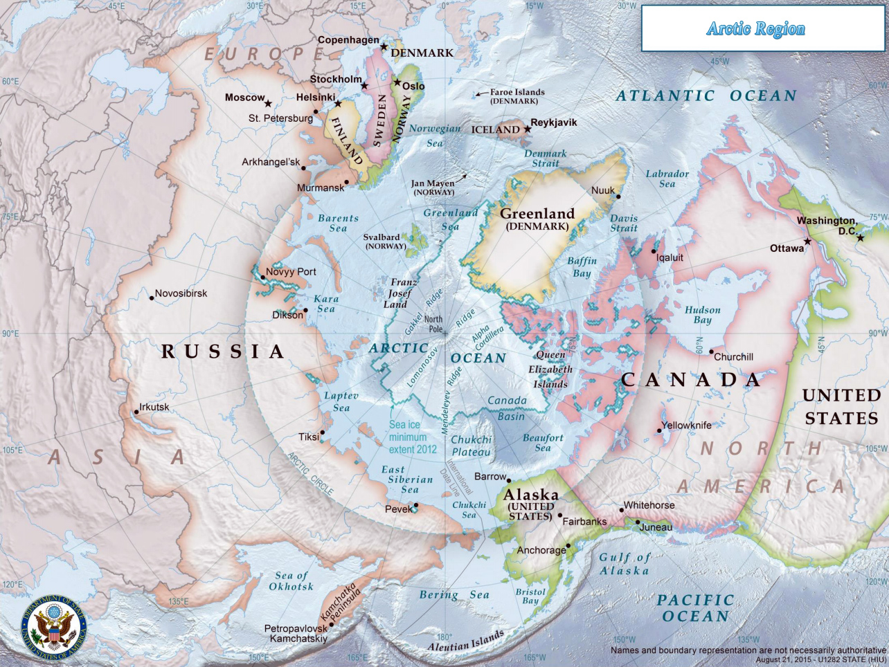
Arctic Ocean Region Map
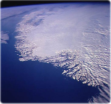
Greenland as seen from space. This north-looking view of southwestern Greenland was taken in November, 1994, and shows numerous indentations, many of which contain small settlements. These fjords were carved by the glaciers of the last ice age 10,000 years ago. Even today, the ice in the center of Greenland is nearly 3,500 m thick and great rivers of ice continuously flow down toward the sea, where they melt or break off as icebergs. Some Icebergs exceed the size of small islands, weigh several million tons, and rise several hundred feet above the sea surface. Cape Farewell is visible toward the bottom right of the view. Julianehab Bay and the Bredev fjord is seen toward the center of the photo. Godthab, the main settlement on Greenland, is barely visible to the north of the Frederikeshabs Icefield near the left center of the view.
The Arctic Ocean is a body of water between Europe, Asia, and North America, mostly north of the Arctic Circle. It includes Baffin Bay, Barents Sea, Beaufort Sea, Chukchi Sea, East Siberian Sea, Greenland Sea, Hudson Bay, Hudson Strait, Kara Sea, Laptev Sea, Northwest Passage, and other tributary water bodies. The Northwest Passage (US and Canada) and Northern Sea Route (Norway and Russia) are two important seasonal waterways. There are 8 Arctic nations: Canada, Denmark, Finland, Iceland, Norway, Sweden, Russia and United States of America (Alaska).


|
Copyright © Geographic Guide - Maps of World - Countries of the Arctic Region. |
Maps of Continents
Map of the Arctic created by State Department geographers as part of the U.S. Chairmanship of the Arctic Council.

Arctic Ocean Region Map