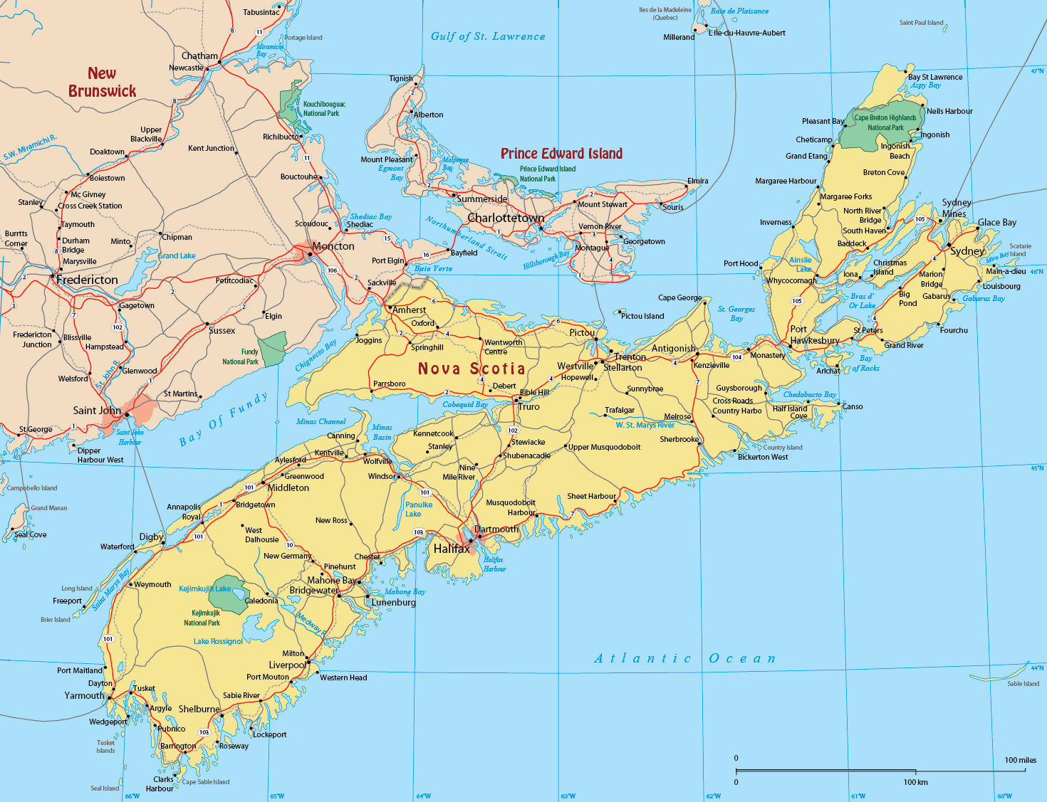
Map of Nova Scotia Canada
Nova Scotia is on the east coast of Canada, one of the Canada’s four Atlantic provinces.

Nova Scotia is Canada's second-smallest province in area, after Prince Edward Island. It is surrounded by four major bodies of water: the Gulf of Saint Lawrence (north), the Bay of Fundy (west), the Gulf of Maine (southwest), and the Atlantic Ocean (east). The province's mainland is the Nova Scotia peninsula and includes numerous bays and estuaries.
Cape Breton Island, a large island to the northeast of the Nova Scotia mainland, and Sable Island, a small island notorious for being the site of offshore shipwrecks, are part of the province.
Churches at Mahone Bay, Nova Scotia.


|
Copyright © Geographic Guide - Maps World, Maps of Canada. |
Map of Nova Scotia Canada